LiDAR Mapping
(UAV/Terrestrial)
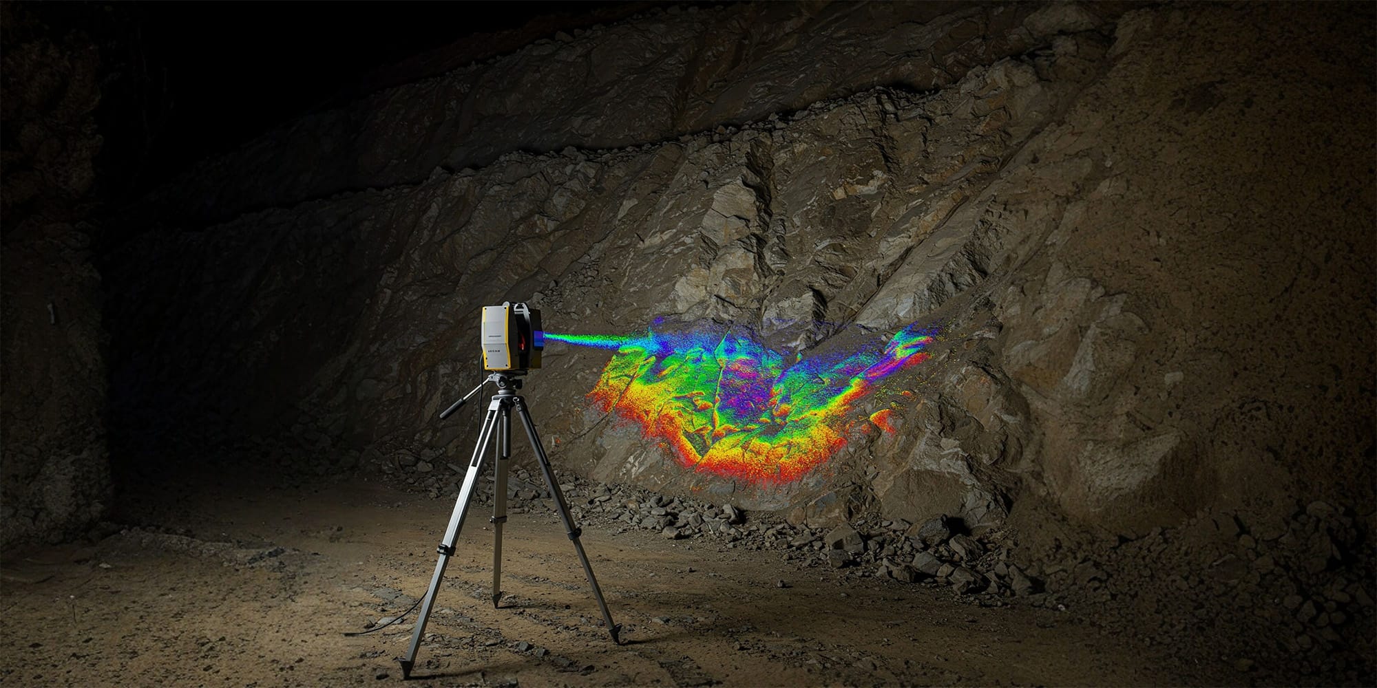
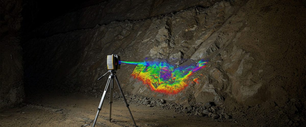
Precision Terrain Modeling with LiDAR.
Advanced UAV and terrestrial LiDAR systems delivering high-density terrain intelligence, 3D reconstruction, and precision mining analytics.
BEYOND THE SURFACE
High-Precision Elevation Data at Every Scale.
LiDAR (Light Detection and Ranging) is a powerful remote sensing method that produces dense, accurate 3D data of any surface — penetrating even dense vegetation to reveal bare earth. In mining operations, LiDAR enables detailed terrain modeling, precise volumetric analysis, and critical safety inspections, ensuring better planning, auditing, and regulatory compliance.
THE DROID ADVANTAGE
Why LiDAR
With Us?
Transforming complex point clouds into ready-to-use engineering intelligence.
Experts with Mining Focus
Our specialists understand mining workflows, ensuring the data we deliver is precisely what your geologists and engineers need.
Certified Pilots & Surveyors
Operations executed by highly trained UAV pilots working alongside certified ground surveyors for guaranteed spatial accuracy.
GIS & Planning Integration
Data delivered in native formats ready for immediate import into Surpac, AutoCAD, Deswik, and other major mining software.
IBM Reporting Formats
Statutory reports and volumetric analyses provided in strict accordance with Indian Bureau of Mines (IBM) guidelines.
Quick Turnaround
Rapid deployment capabilities and efficient cloud-processing pipelines ensure you get your actionable data without delay.
TERRAIN APPLICATIONS
Use Cases
Mine Pit Modeling
Generate high-fidelity DSM/DTMs of complex pit geometry for structural planning.
Dump Yard Volume Estimation
Accurately track overburden, waste material, or backfill quantities over time.
Slope Stability Checks
Create detailed bare-earth slope models to detect micro-failures and ensure safety.
Stockpile Analysis
Automate inventory management with ultra-high-accuracy volumetric scans.
Bench Mapping
Obtain precise measurements of bench heights and widths for extraction control.
SPATIAL OUTPUTS
Deliverables
Actionable Outputs That Drive Decisions
High-Density Point Clouds
Classified LAS/LAZ files containing millions of colored, accurately positioned laser returns.
3D Mesh Models
Fully textured, watertight 3D models (OBJ/PLY) perfect for immersive visualization and planning.
Digital Terrain Models
Bare-earth DTMs where vegetation and structures have been algorithmically stripped away.
Digital Surface Models
DSMs mapping the top-most surface including canopy, stockpiles, and mining infrastructure.
Contour Maps
Crisp, highly detailed topographic lines generated directly from the dense point cloud data.
Frequently Asked Questions About LiDAR Mapping (UAV/Terrestrial)
Clear answers about service use cases, accuracy, deliverables, and mining project workflows.
LiDAR mapping is a high-precision 3D mapping method that uses laser scanning from drones or ground systems.
Combining both gives wide aerial coverage and detailed ground-level precision.
It is used for terrain modeling, stockpile measurement, slope analysis, tunnel mapping, and site planning.
LiDAR captures dense point cloud data and works well in vegetation or complex terrain.
Deliverables include point clouds, DTM/DSM files, 3D meshes, and contour maps.
Accurate Data. Safer Mines.
Smarter Planning.
Get in touch today and book your professional LiDAR mapping survey with Droid Mining Solutions. Digitize your terrain with absolute certainty.
GET IN TOUCH