Satellite Imagery
Analysis
Explore Smarter with Satellite Intelligence.
Leverage high-resolution satellite imagery to map minerals, monitor compliance, and analyze terrain — directly from space, minimizing ground risk and accelerating discovery.
EXPLORATION FROM SPACE
Leverage high-resolution satellite imagery to map minerals, monitor compliance, and analyze terrain — all from space.
Satellite imagery offers a bird’s-eye view of vast exploration zones, giving geologists and mining planners valuable insights without setting foot on-site. From identifying potential mineral hotspots to detecting subtle land use changes, satellites deliver scalable intelligence for every stage of mine planning.
THE DROID ADVANTAGE
Why Work
With Us?
Transforming raw pixel data into targeted geological models. We don’t just provide imagery; we provide answers.
Experts in Remote Sensing
Specialized algorithms and deep expertise in interpreting multi-spectral signatures for highly accurate mineral targeting.
Integrated with GIS
Seamlessly combine space-borne data with your existing ground surveys and CAD models for a unified spatial database.
Tailored Workflows
Interpretations are specifically tailored to aggressive mining workflows, delivering maps formatted exactly for your planning software.
Faster Decision-Making
Drastically reduce expensive and dangerous physical fieldwork costs by isolating high-potential targets remotely first.
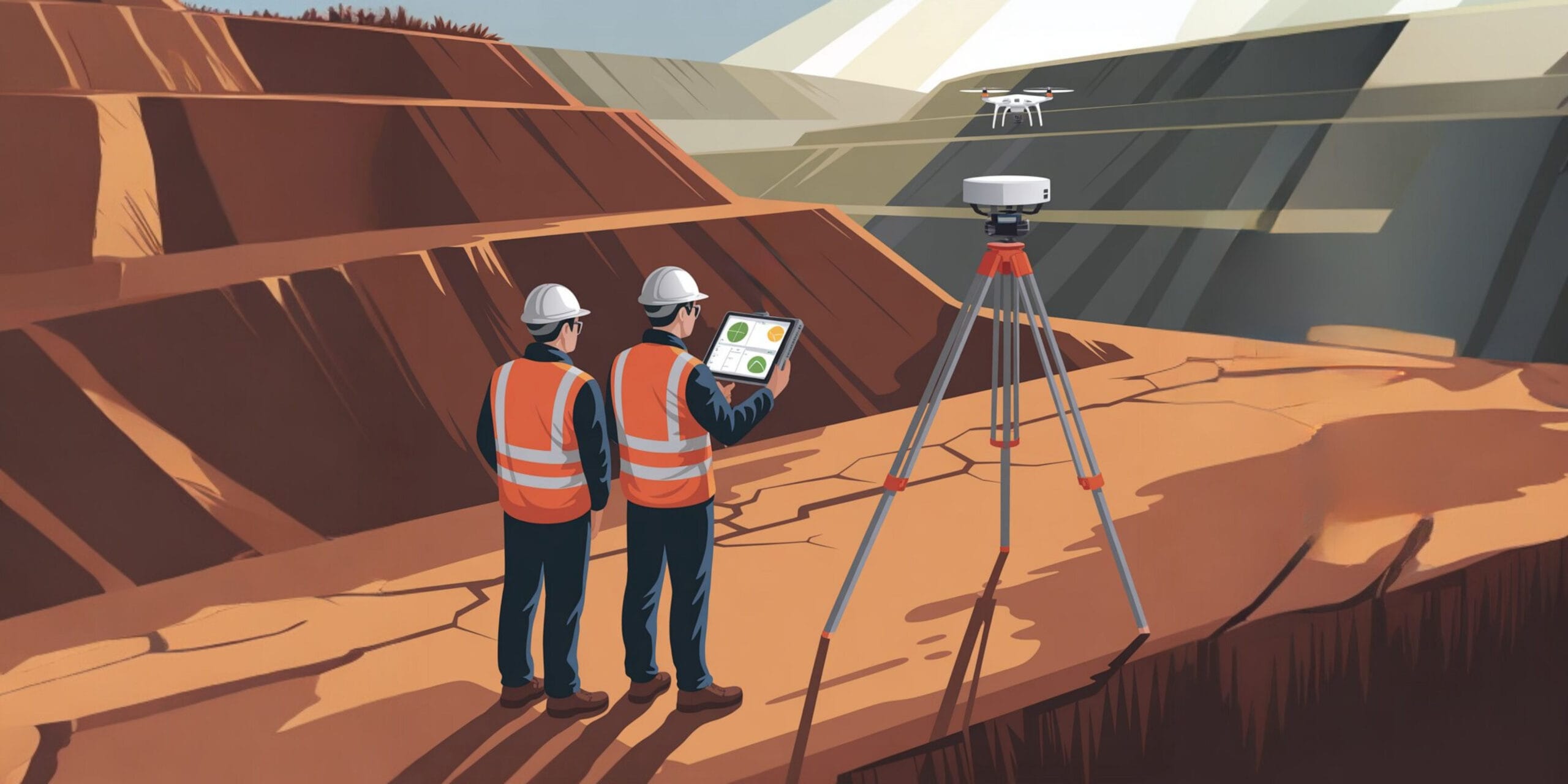
AERIAL APPLICATIONS
Use Cases
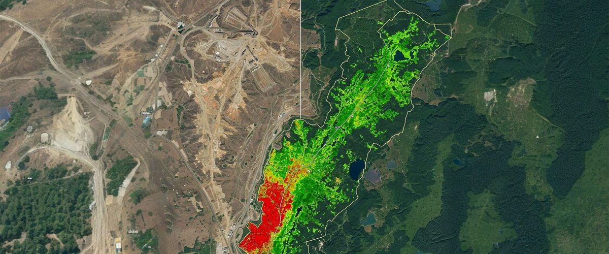
Mineral Potential Mapping
Identify anomalies and high-yield targets using advanced spectral signatures.
Environmental Compliance
Monitor forest encroachment, water body health, and total land disturbance.
Pre-Mining Site Analysis
Evaluate rough terrain, vegetation density, and surface geological formations early.
Reclamation Monitoring
Track vegetation regrowth and environmental rehabilitation post-mining.
Illegal Mining Detection
Identify unauthorized pit activities through rapid temporal change detection.
GIS EXPORTS
Deliverables
Actionable Satellite Data You Can Use Right Away
GeoTIFF Images
High-res, fully geo-referenced raster files ready for immediate CAD/GIS software import.
Thematic Maps
Custom colored maps isolating specific geological formations, vegetation index (NDVI), or water bodies.
Change Detection
Visual maps highlighting exact temporal changes in land mass, pit expansion, and vegetation loss.
KML Overlays
Lightweight vector overlays easily viewable in Google Earth for quick managerial and executive presentations.
Frequently Asked Questions About Satellite Imagery Analysis for Exploration
Clear answers about service use cases, accuracy, deliverables, and mining project workflows.
It is the interpretation of satellite data to identify mineral potential, terrain patterns, and land changes.
It helps screen large areas efficiently before detailed fieldwork begins.
Yes. It can help detect land disturbance, vegetation change, surface patterns, and activity zones.
Mining, environmental monitoring, land management, and infrastructure planning all use it.
Deliverables may include thematic maps, GeoTIFFs, KML files, and change detection reports.
Smarter Planning.
Deeper Insight. Zero Contact.
Get in touch today and book your professional satellite imagery analysis solution with Droid Mining Solutions. Target resources with precision from orbit.
GET IN TOUCH